News and Events
CSU President RCD unveils MapX in LSDF 2019-2040 forum
The Land Sector Development Strategic (LSDF) Framework Plan is a matrix developed in 2010 under the WB-AusAID Land Administration Management Project 2 (LAMP2). It laid down a 20-year strategic land administration and management strategy to implement reforms in the country's land sector.
The LSDF proposed key policies, legislations, and regulatory changes in land administration, public land management, land information management, property valuation, and taxation, and enabling environment and capacity building need to address the weakness and challenges of the Philippine land sector to become a "world-class, efficient land administration and management system".
In 2017, the LSDF was updated through technical assistance from the Food and Agriculture Organisation (FAO) to mainstream with the Voluntary Guidelines on the Responsible Governance of Tenure (VGGT) principles to keep up with the latest trends in land survey technology. This was completed in 2018 but has no binding implementing agreement between land administration and titling agencies.
In this context, the GIZ Project on the "Enhancement of the LSDF 2019-2040" was initiated in October 2019 to continue the updating and enhancement of the LSDF and align it with global and international land administration and governance practices as well as create the necessary national and local environment for its institutional adoption and implementation.
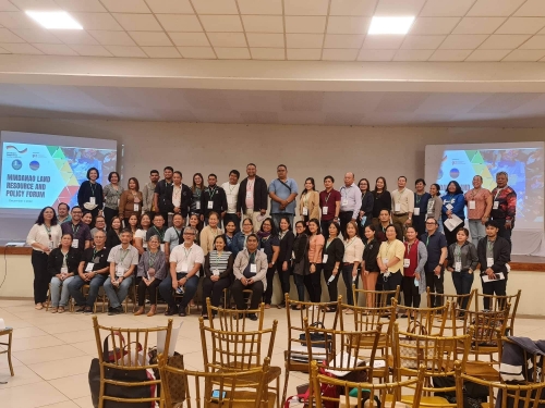
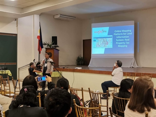
In pursuit of continuous enhancement of critical policies and tackle the future direction in land management, the GIZ, German Cooperation, in partnership with the Department of Environment and Natural Resources, Land Management Bureau, and Foundation for Economic Freedom, conducted a forum on Future Direction and Strategies: Land Sector Development Framework 2019-2040 last December 1-2, 2022 at Almont Inland Resort Hotel in Butuan City.
CSU President Rolyn C. Daguil presented MapX: Manage Your Assets, Properties and Map It For Visualization. MapX is a translated product and service and the first spinoff of Caraga State University. It is a complete real property mapping and assessment solution using advanced geospatial technologies and artificial intelligence. The event was participated by DA, DENR, DHSUD, LRA, NEDA, NCIP, and assessors from different regional municipalities and cities. President Daguil attended the event with Engr. Cherry Bryan Ramirez, Resident Engineer and Ms. Ferlyn Daguil, Project Development Officer for MapX.
The Philippine Development Plan (PDP) 2017-2022 and Ambisyon 2040 goals identify the critical role and contribution of the sustainable management, use, and development of the country's land resources to these long-term national development objectives, poverty eradication, and resilience. NKB/pico
Admissions
Registrar
Guidance
Office of the President
Public Information and Communication Office
Course Particulars
College of Engineering and Geo-Sciences
College of Agricultural and Agri-Industries
College of Mathematics and Natural Sciences
College of Forestry and Environmental Sciences
College of Computing and Information Sciences
College of Education
Philippine Standard Time
Transparency Seal
Design by ICT Center.

